Denver Colorado Mountains: Your Complete Guide to the Rockies Near the Mile High City
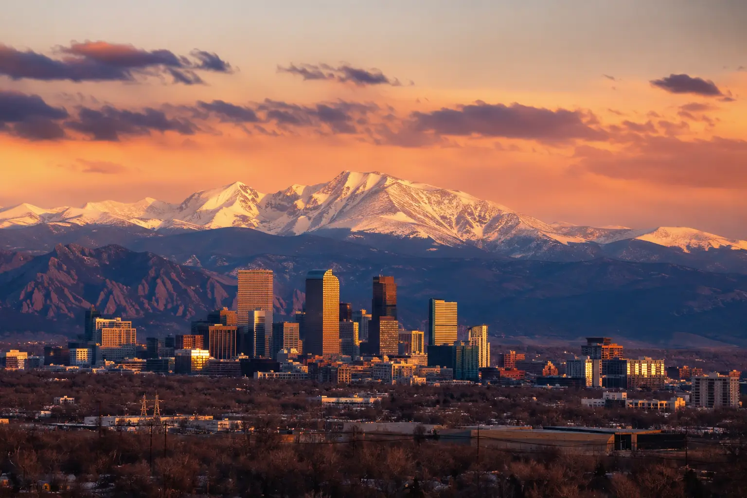
You booked a flight to Denver, Colorado, expecting mountains right outside your window. Then you land, and all you see is flat, dry plains stretching in every direction. Where did the Rockies go? This confusion trips up thousands of first-time visitors every year, and it can throw off an entire trip if you don’t understand the local geography ahead of time.
The good news is that the Denver, Colorado, mountains are closer than you think. You just need to know where to look and how to get there. This guide walks you through the real geography, the peaks you can actually see from the city, and the fastest ways to reach the mountains near Denver, whether you have one afternoon or a full week to explore.
Is Denver Actually in the Mountains?
No, Denver is not in the mountains. It sits on the high plains, right at the eastern edge of the Rockies, in an area geologists call the Denver Basin. Locals often refer to this stretch of land as the Front Range.
Because of this location, Denver earned the nickname “Mile High City.” The elevation at Civic Center Park sits at exactly 5,280 feet, which is one mile above sea level. That said, the true Denver, Colorado, mountains rise sharply just west of the city, and the change in scenery happens fast once you start driving in that direction.
So while the skyline doesn’t touch the peaks, the mountains near Denver are still remarkably close. In fact, most travelers can be standing in an alpine forest within 45 minutes of leaving downtown, which is part of why the city draws so many outdoor-minded visitors year after year.
Which Mountains Can You See From Denver?
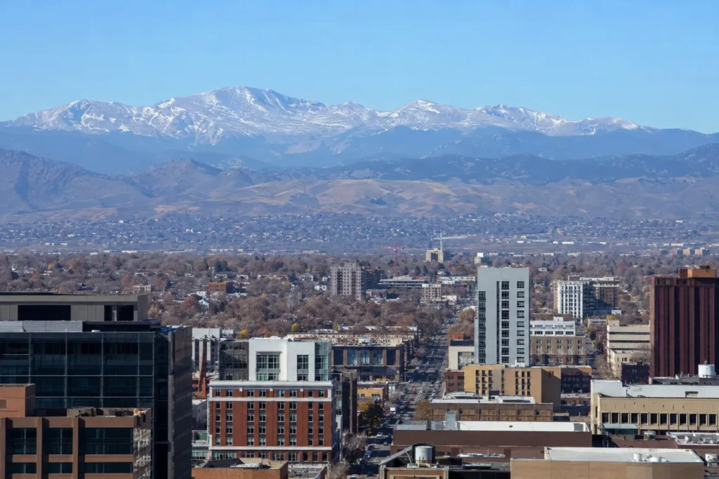
Here’s where most guides fall short. Everyone says the mountains are visible, but few explain which mountains you’re actually looking at.
On a clear day, several named peaks stand out along the western skyline. Mount Blue Sky, formerly called Mount Evans, is usually the most obvious high point. Longs Peak rises to the northwest and is easy to spot from spots like the 16th Street Mall. Meanwhile, Pikes Peak appears far to the southwest, near Colorado Springs, and the Flatirons near Boulder round out the view to the north.
Here’s a quick reference for the most visible Denver mountains:
|
Peak |
Elevation |
Direction From Denver |
Straight-Line Distance |
|---|---|---|---|
|
Mount Blue Sky (Evans) |
14,264 ft |
West |
60 miles |
|
Longs Peak |
14,259 ft |
Northwest |
75 miles |
|
Pikes Peak |
14,115 ft |
Southwest |
65 miles (driving there takes closer to 110 miles) |
|
Grays Peak |
14,278 ft |
West |
60 miles |
|
Torreys Peak |
14,275 ft |
West |
60 miles |
|
Mount Bierstadt |
14,065 ft |
West |
60 miles |
These six peaks make up the Front Range fourteeners, meaning each one rises above 14,000 feet. Because they sit so close to the city, they’re some of the most climbed mountains in the entire state, and a few even share trailheads for hikers chasing more than one summit in a day.
The Closest Mountains to Denver
Not every mountain experience requires a full day trip. Some of the closest mountains to Denver sit just outside the suburbs, well within reach of a short afternoon drive.
Foothills, 15 to 30 Minutes From Downtown
- Lookout Mountain
- Mount Falcon
- Mount Galbraith
- Genesee Mountain
These foothills rise between 6,000 and 9,000 feet. As a result, they’re accessible almost year-round, even when the higher peaks are buried in snow.
Front Range 14ers, 60 to 85 Minutes From Downtown
For travelers chasing higher elevation, the six 14ers listed above sit roughly an hour to 90 minutes away by car. Grays Peak and Torreys Peak even share the same trailhead near the Continental Divide, so hikers often summit both in a single outing.
Best Denver Mountain Parks You Can Visit in a Day
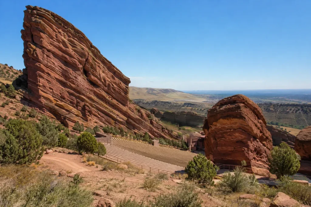
Denver actually owns a mountain park system, and it’s one of the city’s best-kept secrets. In 1914, Congress allowed Denver to buy scenic land far outside its city limits to protect it for future generations. Today, that system covers roughly 14,000 acres in the foothills, all owned and maintained by the city itself.
For example, a few standouts include:
- Red Rocks Park and Amphitheatre — A natural sandstone amphitheater and one of the most famous concert venues on earth. It’s free to visit and hike when no show is scheduled.
- Lookout Mountain — Home to the Buffalo Bill Museum and Grave, with sweeping views back toward the city and out toward the peaks.
- Genesee Park — Denver’s largest mountain park, where a small bison herd still roams near I-70.
- Mount Blue Sky Scenic Byway — The highest paved road in North America, climbing past Echo Lake all the way to the 14,264-foot summit.
Because these parks sit inside Denver’s official boundaries of ownership, they offer an easy way to experience real mountain scenery without committing to a full mountain town getaway. Many locals treat them as a weekend routine rather than a special occasion.
Rocky Mountain National Park: Denver’s Iconic Mountain Getaway
No conversation about the Denver, Colorado mountains is complete without Rocky Mountain National Park. Located about 70 miles northwest of the city, RMNP protects more than 415 square miles of alpine terrain, including 77 mountains taller than 12,000 feet and 147 named lakes.
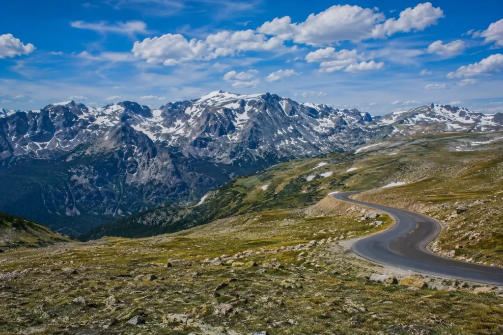
Inside the park, you’ll find montane meadows, subalpine forests, and true alpine tundra above the treeline. Elk are common in the fall, and the drive up Trail Ridge Road offers some of the highest paved views in the country, crossing the Continental Divide along the way.
Notably, Estes Park serves as the main gateway town, sitting right at the park entrance. Between late May and mid-October, the park requires a timed entry reservation during peak hours, so it’s worth checking the current entry requirements before you go.
Popular Mountain Towns Near Denver
If you’d rather stay overnight than drive back the same day, several mountain towns near Denver make for an easy getaway. Here’s how they compare:
|
Town |
Distance |
Drive Time |
Known For |
|---|---|---|---|
|
Golden |
15 miles |
25 minutes |
Historic downtown, Coors Brewery |
|
Idaho Springs |
22 miles |
30 minutes |
Hot springs, rafting, gold mining history |
|
Evergreen |
30 miles |
40 minutes |
Lakeside village, hiking trails |
|
Georgetown |
45 miles |
50 minutes |
Victorian architecture, scenic railroad |
|
Estes Park |
66 miles |
1 hour 25 minutes |
Gateway to Rocky Mountain National Park |
|
Winter Park |
66 miles |
1 hour 20 minutes |
Skiing, mountain biking, alpine slide |
|
Breckenridge |
80 miles |
1 hour 30 minutes |
Ski resort, historic Main Street |
Each town offers its own personality, so the right pick depends on what you want out of the trip. Golden works well for a quick afternoon visit, while Breckenridge suits travelers planning a longer stay in the mountains near Denver.
Getting From Denver International Airport to the Mountains
Most trips to the Denver, Colorado, mountains actually start at Denver International Airport, and this is one detail that many travel guides skip entirely.
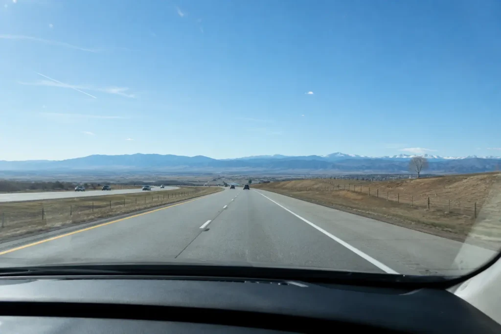
DEN sits about 25 miles northeast of downtown Denver, which puts it even farther from the mountains than the city center. Consequently, travelers heading straight into the foothills or up I-70 should plan for extra drive time from the airport itself, not just from downtown.
At DIA Parking, we work with travelers heading to the mountains near Denver every week, and one question comes up constantly: should you rent a car or book a shuttle straight from the terminal? Generally speaking, a rental car in Denver offers the most flexibility for stopping at scenic overlooks along the way. On the other hand, a shuttle removes the stress of mountain driving, especially during winter storms when I-70 can slow to a crawl through the canyons.
In addition, if you’re driving your own vehicle to the airport before a mountain trip, or picking one up on return, planning your parking ahead of time can save real hassle. Long security lines and shuttle waits add up fast when you’re also racing daylight to reach a trailhead.
Best Time of Year to Visit the Mountains Near Denver
Timing matters more in the mountains than it does in the city. Here’s a quick breakdown by season:
- Summer (June to August) — Warmest weather, but also the most crowded trails and frequent afternoon thunderstorms.
- Fall (September to October) — Cooler air, golden aspen trees, and noticeably thinner crowds.
- Winter (November to March) — Prime skiing season, though many high-elevation roads close due to snow.
- Spring (April to May) — Unpredictable weather, with snow still possible at higher elevations.
Because mountain weather changes quickly, it’s smart to check road and trail conditions on the same day you plan to travel, regardless of season.
Tips for First-Time Visitors to the Colorado Mountains
Before heading up in elevation, keep a few essentials in mind:
- Watch for altitude effects. Even Denver’s 5,280-foot elevation catches some visitors off guard, and true mountain elevations climb far higher.
- Pack sun protection. UV exposure increases with altitude, so sunscreen matters even on cool days.
- Bring extra water. Dehydration happens faster at elevation than most people expect.
- Check road closures. Many high-altitude roads, including sections of the Mount Blue Sky Scenic Byway is closed seasonally.
- Plan around afternoon storms. Lightning is a serious risk above the treeline, so aim to summit before noon during the summer months.
We’ve heard from countless travelers who assumed a short drive into the Denver mountains would feel just like home. Between the elevation and the fast-changing weather, a little preparation goes a long way toward a safer, more enjoyable trip.
Frequently Asked Questions
What mountains are in Denver, Colorado?
Denver itself sits on flat plains, not inside the mountains. However, the city can see several named peaks nearby, including Mount Blue Sky, Longs Peak, and Pikes Peak, all part of the Front Range section of the Rocky Mountains.
What part of Colorado has the best mountains?
The Front Range, just west of Denver, offers the easiest access to high peaks. For deeper mountain scenery, many travelers also head toward Summit County, the Vail Valley, or Rocky Mountain National Park.
Can I see the Rockies from Denver?
Yes. On clear days, the Front Range is visible from many spots around the city, including downtown streets, City Park, and several rooftop viewpoints.
What are the closest mountains to Denver, Colorado?
The closest foothills, including Lookout Mountain and Mount Falcon, sit just 15 to 20 miles from downtown. The closest true 14ers, like Mount Bierstadt, sit around 60 miles away.
Final Thoughts
Overall, Denver may not sit inside the Rockies, but few cities in the country offer this level of mountain access. Within an hour or two, travelers can move from a mile-high downtown skyline to alpine tundra above 12,000 feet, and that kind of range is rare anywhere else in the United States.
Whether you’re planning a quick foothills hike, a full day at Rocky Mountain National Park, or an overnight stay in one of the mountain towns near Denver, understanding the geography ahead of time makes the whole trip smoother. And if your journey starts or ends at Denver International Airport, a little planning around parking and drive times can help you spend more time enjoying the Denver, Colorado, mountains and less time stuck in logistics.